|
SanJuanTriangle
home page
At the Bonita Peak Mining District, EPA works with state, local, and
other federal officials to implement cleanups. The Bonita Peak Mining
District site includes 48 historic mines or mining-related sources where
ongoing releases of water and sediments containing metals occur at
historic mining source areas. The mining source areas directly impact
Mineral Creek, Cement Creek and Upper Animas River drainages in San Juan
County, Colorado. Some metals contamination migrates into the Animas
River.
To date, EPA has conducted site wide investigations and carried out
interim and emergency actions. EPA’s goal is to reduce immediate risks,
stabilize mine waste, and treat ongoing acid-mine drainage. Expected
results include sustained reductions in contamination and protective
final remedies for major source areas.
For more information, please refer to EPA’s Bonita Peak Mining District
Site profile page: epa.gov/bpmd”
|
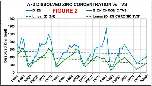
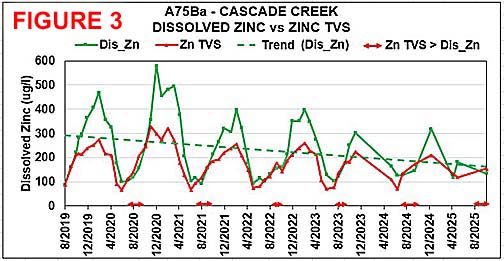
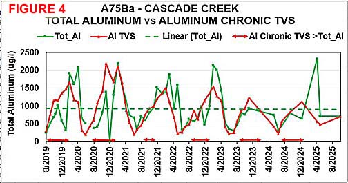
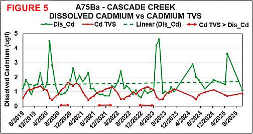
WATER QUALITY
AT THE SAN JUAN TRIANGLE and ANIMAS |
|
|
|
|